
Overview
Map the way forward with GIS
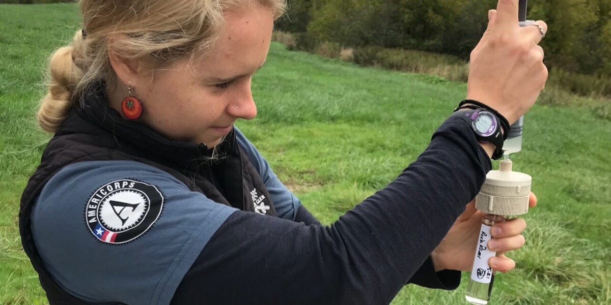
Thanks to satellites, millions of images of the Earth and human activities are at our fingertips. Computers store massive amounts of data and digital software is rapidly developing. Yet, how do we make sense of all this data to create positive change? That’s where skills in Geospatial concepts come in.
This 4-course, non-credit GIS certificate program covers Geographical Information Systems (GIS), remote sensing, geospatial computation, and data communication. All so you can turn big data into useful information that helps solve real-world problems whether socioeconomic or environmental.
Whether you’re new to the industry or looking to advance your career, the program is customizable based on your interests and designed to improve your critical thinking and applied problem-solving skills.
Why choose GIS at UVM?
Learn the Latest Software
Using ESRI’s ArcGIS and other leading software, you’ll translate a range of geospatial data into layered maps that allow complex themes to be communicated to wider audiences.
Build on Our GIS Credibility
Establish your credibility in the world of GIS with UVM, a recognized leader in the use of geospatial technologies and research.
Gain Advanced Skills
You’ll learn to go beyond “off the shelf” buttons toward the ability to customize workflows, scripts, or models in Python and R.
“GIS and geospatial analysis is a lot more than a map…a map is a product, but what we’re talking about is the integration of information and analysis of information. It’s a really powerful strategy to answer questions.”
Gillian Galfor, GIS Certificate Affiliated Faculty
Who is GIS right for?
If you love maps, data, and technology and have a passion for sparking positive change in the world, you’ve come to the right place.
Whether you’re looking to get started in GIS, or want to expand your skill set, UVM’s GIS certificate program is right for you if you want to:
- Empower leaders with tools to make more informed decisions.
- Be curious and investigate what-if scenarios.
- Engage with real-world applications and the latest technologies.
- Pursue your passion for biodiversity conservation, forest fire suppression, agricultural monitoring, humanitarian relief, and much more.
UVM’s GIS & Data Communication Professional Certificate is designed to help you succeed in the growing field of GIS and geospatial analysis. No prior GIS experience or background in coding or computer programming is required.
“Given the scope of this course, it’s completely appropriate for a beginner and novice to both coding and remote sensing to be comfortable and not overwhelmed…in taking these courses a key skill you’ll acquire is the ability to be able to decipher what you’re seeing when you’re looking at any map.”
Amanda Armstrong, NASA Senior Research Scientist and UVM GIS instructor
Curriculum
Choose four courses and when to take them
This 4-course certificate is fully online and designed to be completed within one year with the option of extending based on your individual academic needs. To provide you with maximum flexibility, you choose the 4 courses from the list below based on your interests, experience level, and schedule. All courses are 8-9 weeks long.
While the program focuses on a handful of software tools, the introductory course will help students adapt to new or preferred software. Students will also increase their understanding of data collecting in the field with GPS and apps, problem-solving with spatial analysis in ArcGIS, map-making through cartography and data visualization, and environmental modeling.
By the end of this program, you will have gained the skills to:
- Use ArcGIS Pro as a tool to learn conceptual underpinnings of and practical applications of GIS.
- Harness remote sensing as a tool for environmental or landscape problem-solving.
- Analyze data to reveal patterns and relationships to better inform decision-makers.
- Create impactful maps and visualizations of large and complex datasets that encourage comparison and visual analysis by the viewer.
- Go beyond “off the shelf” buttons towards the ability to customize workflows, scripts, or models in Python.
| Course | Summer 2026 | Fall 2026 |
| Introduction to GIS | 7/27/2026 – 9/27/2026 | 10/12/2026 – 12/20/2026 |
| Introduction to UAS and Geospatial Applications | ||
| Advanced GIS | 9/28/2026 – 12/06/2026 | |
| Data Visualization and Communication | 8/31/2026 – 11/1/2026 | |
| Environmental Modeling | ||
| Remote Sensing Foundations | 8/31/2026 – 11/1/2026 | |
| Geospatial Computation | 8/31/2026 – 11/1/2026 | |
| Independent Study* | 7/13/2026 – 9/13/2026 | 9/14/2026 – 11/8/2026 |
*The Independent Study requires the student to submit a proposal. Please view the GIS & Data Communication Independent Study under course descriptions for more information
Sample Curriculum with a Fall Start
- July – Sept.: Intro to GIS
- Oct. – Dec.: Advanced GIS
- Jan. – March: Remote Sensing Foundations
- April – May: GIS Independent Study
Not sure whether to start with the intro or advanced course? Check out our FAQ.
Course Descriptions
Snapshot:
Instructor: Dennis Baldwin
Do I enroll in Introduction to GIS or Advanced GIS?
A Geographic Information System (GIS) is a computer-based tool for managing, documenting, analyzing, and presenting data and information. GIS allows us to investigate the spatial (location, size, and shape), temporal and descriptive qualities (e.g. population, % coverage) of data across multiple disciplines and is increasingly used to tell complicated “stories” using printed and web-based materials.
This course uses the most current version of ESRI’s ArcGIS Pro software.
This course will introduce the student to the basic principles and techniques of GIS through a mixture of readings, videos, slide-based presentations, and real-world examples. Participants will gain practical skills in the application of GIS to data analysis and problem-solving through the completion of lab assignments and participation in the course Discussion Forum.
By the end of the course, the student will be able to:
- Develop a practical understanding of GPS and ArcGIS concepts (e.g., data & file types, projections & coordinate systems, and spatial relationships) & geoprocessing techniques
- Perform spatial analysis using desktop and web-based ArcGIS software
- Practice effective communication using the (technical) language of ArcGIS, presentation-quality maps, and web applications
- Use best practices for creating, storing, and managing data in a variety of geospatial and tabular formats
- Gain experience identifying and accessing publicly available data
Learn more about the Intro to GIS course.
Instructor: TBD
Note: General GIS experience required; Completion of Intro to GIS preferred. Students will need access to a camera (cell phone or any type of camera).
Unoccupied Aircraft Systems (UAS), or drones, are transforming how we map, monitor, and measure our changing landscapes. This course provides a comprehensive introduction to using small UAS for remote sensing, with a focus on applied learning through real-world scenarios.
Delivered fully online, the course emphasizes simulation-based learning and virtual mission planning. Students will engage with the University of Vermont’s UAS Team to explore safe drone operation, flight planning, geospatial data acquisition, and the creation of high-resolution maps and 3D models, through digital tools and platforms.
Technologies covered include UAS platforms and sensors, flight planning software, image processing tools, and desktop and web-based GIS applications. Learning materials include video lectures, readings, tutorials, and interactive discussions using YellowDig.
By the end of the course, you will be able to:
- · Recognize the capabilities and limitations of UAS for remote sensing
- · Identify environmental applications of drone-based mapping and monitoring
- · Safely acquire and process UAS datasets including imagery and video
- · Plan and simulate automated UAS missions tailored to specific research questions
- · Create, analyze, and share geospatial products using industry-standard tools
- · Design and present a comprehensive UAS mission plan for a real-world application
Snapshot:
Instructor: Dennis Baldwin
Note: You need to have completed Introduction to GIS or received prior instructor approval before enrolling in this course.
Do I enroll in Introduction to GIS or Advanced GIS?
Geographic Information Systems (GIS) are increasingly featured as an integrating technology for analyzing economic, social, and environmental data. This course will expose the learner to advanced techniques for collecting, curating, analyzing, and understanding spatial data and communicating technical findings to a broad range of audiences. Building on the content of the Introductory Course, Advanced GIS will prepare the student to independently conduct spatial analyses.
This course uses the most current version of ESRI’s ArcGIS Pro software.
Learning materials will include a mixture of readings, videos, slide-based presentations, and critical evaluation of real-world examples. Participants will gain practical skills in the application of ArcGIS to data analysis and problem-solving through the completion of lab assignments and participation in the course Discussion Forum.
By the end of the course, the student will be able to:
- Use best practices for creating, storing and managing data in a variety of geospatial and tabular formats
- Integrate public data resources from multiple repositories (e.g. The National Map, US Census Bureau, Vermont Center for Geographic Information) into a cohesive analytic framework
- Identify ethical questions surrounding data creation, analysis, and representation
- Apply advanced vector (e.g. network analyses, attribute conflation, queries) and raster (e.g. hydrology, interpolation, raster calculator) geoprocessing tools to analyze spatial data
- Automate geoprocessing workflows using Model Builder and the Python programming language
- Apply critical thinking skills to assess the suitability of available data (e.g. scale, resolution, accuracy, and currency) and/or geoprocessing approaches for addressing real-world issues
- Acquire the necessary skills to develop and execute a project requiring GIS as a management, analytical, and/or visualization tool
- Practice effective communication using the (technical) language of GIS, presentation-quality maps and web applications
Learn more about the Advanced GIS course.
Snapshot:
Instructor: Simran Parwani
Decisions in our work lives are driven more and more by data. Analyzing this data can reveal patterns and relationships that can be used to better inform decision-makers. One way to present this analysis is through data visualization, which is the graphical representation of information.
Visualizations such as charts, graphs, or maps can help make data easier to understand, leading to better decisions. Data-driven decisions could mean the difference between the success or failure of any organization. There are many tools for visualizing data, but without a solid grasp on the fundamentals of graphic design and perceptual theory, visualizations may not convey the intended message.
The course uses the most current versions of the Google Suite and ESRI’s ArcGIS Pro software.
This course will introduce students to the fundamentals of data visualization and communication. Students will learn the ways humans use their cognitive and perceptual abilities to comprehend information, best practices for creating compelling and effective data visualizations, and the many nuanced factors influencing the successful application of these practices.
By the end of the course, the student will be able to:
- Apply a framework for communication to get the right people to the right content at the right time
- Recognize, explain, and identify solutions for some of the challenges we face working with data
- Produce an entire conceptual data story in a form that will allow for future execution of detailed individual components
- Describe human visual perception and apply it to specific design and visualization decisions
- Effectively use visual variables such as size, value, texture, color, orientation, and shape to communicate information
- Recognize the purpose for different data visuals and when and how to apply them
- Create impactful maps and visualizations that enable understanding of complex information
Learn more about the Data Visualization and Communications course
Snapshot
Instructor: Daniel Erickson
Note: Completion of Introduction to GIS required.
Environmental modeling helps us simulate and predict natural processes across space and time. This fully online course introduces students to spatially explicit simulation models for a range of terrestrial-based applications from wildfires and flooding to habitat connectivity and climate change.
Students will work with geospatial datasets at local, regional, and global scales using ArcGIS Pro and specialized modeling platforms such as Circuitscape, FlamMap, and Dyna-CLUE. Weekly lab assignments and an independent project guide students through designing geospatial workflows, building models, and communicating results using ArcGIS StoryMaps.
Technologies covered include ArcGIS Pro ModelBuilder, Suitability Modeler, species distribution modeling, hydrologic and wildfire simulation tools, and global climate datasets.
By the end of the course, you will be able to:
- · Articulate the benefits and limitations of environmental modeling
- · Design and implement geospatial modeling workflows using ArcGIS Pro
- · Simulate environmental processes using spatial data and modeling platforms
- · Communicate modeling results effectively to technical and non-technical audiences
- · Apply modeling tools to new locations and environmental challenges
- · Share your work through a professional-quality ArcGIS StoryMap
Snapshot:
Instructor: Eva Kinnebrew
Significant advances in access to geospatial datasets and cloud-based computing resources have ushered in a new era of user-friendly big data analysis, and satellite remote sensing has become a critical component of many environmental research and monitoring programs. However, effective use of satellite imagery requires a foundational understanding of sensor, image, and surface characteristics as well as methods for translating analysis-ready data to decision-ready analysis.
This course will introduce students to fundamentals of remote sensing theory and image processing techniques using the Google Earth Engine platform, which “combines a multi-petabyte catalog of satellite imagery and geospatial datasets with planetary-scale analysis capabilities.” By integrating hands-on practical training with evidence-based experiential learning, students will establish a basic understanding of how to use remote sensing as a tool for environmental problem-solving. This course uses Javascript for creating geospatial workflows in the Google Earth Engine Code Editor; any coding background is helpful but not required.
By the end of the course, the student will be able to:
- Demonstrate the physical processes involved in the acquisition of remote sensing imagery, as well as the unique spectral, spatial, temporal and radiometric properties of different image sources
- Identify what constitutes a remotely sensed data product
- Build a working knowledge of a wide array of geospatial datasets available in the Earth Engine Data Catalog, including optical, thermal, and microwave imagery from the Landsat, MODIS, Sentinel-2, and Sentinel-1 satellites, and derived products such as the Hansen Global Forest Change and JRC Global Surface Water datasets
- Use the Earth Engine Code Editor to develop basic geospatial workflows using the JavaScript API
- Use static and interactive data visualization techniques including tables, maps, charts, GIFs and Earth Engine Apps
- Apply standard multi-spectral and multi-temporal image processing techniques, including basics of land cover classification and change detection
- Develop a portfolio of example scripts, data visualizations, and analyses across a range of environmental application areas
Snapshot:
Start Date: Fall, 2026
Registration Deadline: Fall, 2026
Instructor: Deidre Zoll
Geospatial Computation is the study of general computational methods applied to spatial and spatiotemporal data for exploratory, confirmatory, descriptive, or predictive analysis. This course introduces foundational concepts in geospatial computation and its applications in spatial data science within the context of geographic information systems (GIS). Computational approaches in spatial simulation, exploratory data analysis, predictive analysis, and geospatial data visualization will be elaborated. Implementation of data-science geospatial approaches in ArcGIS will be covered in the context of spatial problem-solving in a string of applied computational project assignments. Prior experience with ArcGIS is required.
This course uses the most current version of ESRI’s ArcGIS Pro software. Access to software will
be provided by the department.
By the end of this course, the student will be able to:
- Apply appropriate geo-computational approaches in spatial data science for a wide variety of spatial problems
- Apply and interpret spatial pattern mining, spatial regression, and exploratory data analysis
- Recognize stages of spatial analysis that rely on geospatial computation
- Develop repeatable analysis workflows leveraging GIS
- Create and present a project and professional quality story map based on your research
questions and data - Apply knowledge of GIS approaches to geospatial computation
Snapshot
Applications will be reviewed by the selected mentor on a rolling basis. Applications are due two weeks before the session’s start date.
Study proposals include but are not limited to topics in: Agriculture, Education, Environment, Environmental Justice, Data Science, Engineering, Food Systems, Forestry, Government, Health, Natural Resources, Water Resources, Urban Planning, Transportation, Marketing/Market Research. Technical approaches may focus on student-identified topics in GIS, remote sensing, and data communication.
Independent Study Process
Prerequisites
1. You must have successfully completed:
- Intro to GIS and
- Advanced GIS
- Or receive approval of equivalent experience.
2. You have selected an Independent Study mentor from our list of instructors. We encourage students to contact their identified mentor before submitting the proposal.
Proposal Process
Prospective students should fill out the GIS Independent Study Proposal.
Proposal Components
- Proposed Independent Study Description
- Educational Learning Objectives
- Scaffolded Learning
- Approach / Methods
- Deliverables and Evaluation
- Bibliography
- Mentor Check-ins
Upon submission, the form is sent to the mentor of choice. The mentor has up to 5 business days to review the proposal and confirm their availability.
If approved:
- The mentor will contact you directly to confirm approval.
- The PACE GIS Team will contact you with registration details.
If not approved:
- The PACE GIS Team will contact you.
Learning Objectives
By the end of this course, you will be able to:
- Develop customized learning objectives in collaboration with your mentor.
- Design and complete a project with a clear study question whose answer(s) are derived through the application of GIS, remote sensing, data visualization, geospatial computation or related analyses.
- Find, process and apply data to investigate a study question.
- Revise study design, initial results and findings based on targeted feedback from your mentor.
- Adapt project goals based on data availability, format or other logistical constraints.
- Present professional quality study findings that effectively communicate the results of your work.
What is an Independent Study?
An independent study is a major project intended to allow students to reinforce and polish their GIS and data communication skills. Participants design their own project which attempts to answer a specific question. Projects should involve the integration of GIS, remote sensing concepts and / or data visualization, spatial and tabular data sets and the use of geospatial and statistical methods. After defining the scope, students should plan on spending 10-12 hours each week working on the project for the 8-week course. They will have meetings once per week at a selected, predetermined time with their Independent Study Mentor. The purpose of these meetings is to ensure that adequate progress is being made and that the final product will meet the educational objectives defined by the student.
What are some examples of Independent Study Projects?
We encourage you to browse through our GIS Independent Study Student Showcase. The projects in the Showcase provide an example of the diversity of projects completed by the GST Certificate students. Check back often as more projects will continue to be added to the Showcase.
What is an Independent Study Mentor?
An Independent Study Mentor is an experienced professional who has agreed to mentor a student in the independent study project. The mentor engages in regularly scheduled check-ins (e.g., weekly) to evaluate student progress, advise on critical decision points, and foster student problem-solving. Ideally, the mentor’s area of expertise is aligned with the student’s project to the extent they might advise on data sets or methodologies, although the mentor is not meant to be a technical troubleshooter. The UVM GIS Certificate Program has a number of mentors available to work with 5-6 students per year based on their availability.
Student Stories
GIS Alumni Testimonials
The GIS Certificate program has been a catalyst for career transformation, empowering our students to master advanced geospatial computation using Python and R computer languages. Through practical, project-based learning, they gain the technical expertise not only to analyze and model spatial data but also to communicate their findings clearly and effectively—whether through dynamic maps, reports, or digital media.
These skills open doors across diverse industries, enabling graduates to make a real impact in their fields. Discover how our GIS alumni have turned their passion for data and mapping into meaningful professional achievements.
“Satellites in space can detect nearly anything – air pollution, algae blooms – and working with that data was very cool.”
Alison Spasyk, UVM GIS Certificate Graduate
“I’m drawn to this field for climate change, and environmental management and remediation….[there is] huge potential for social planning applications and to address social justice issues with GIS.”
Charlotte Reining, UVM GIS Certificate Graduate
“The GIS Certificate program gave me the technical expertise to analyze spatial data, which directly enhanced my ability to make informed decisions in municipal planning and zoning. It was a game-changer for my career.”
Taylor M., Urban Planner
“Learning GIS tools significantly improved my contributions to wildlife conservation projects. I can now map habitats more accurately, leading to better preservation strategies.”
Alex R., Conservation Biologist
“Thanks to this program, I developed the skills to create detailed emergency planning maps that serve as critical tools for disaster response teams in my organization.”
Jordan L., Emergency Management Specialist
“Mastering GIS technology through this certification enabled me to better plan construction projects by assessing environmental impacts and optimizing site designs.”
Morgan S., Construction Project Manager
More GIS Stories You Might Like:
- Education
- Environment & Sustainability
- Vermont
Tracking Down Vermont’s Endangered Plant Species with GIS

- Education
- Environment & Sustainability
Why Not Complete the Whole Certificate? Alison Spasyk Goes All in on GIS at UVM.
- Environment & Sustainability
Earn an Online GIS Certificate at UVM in 12 Months
Learn from NASA Senior Research Scientist Amanda Armstrong
How GIS is helping to reduce deforestation
GIS is enhanced by the derivation of information from remote sensing, such as digital images of the earth used to map roads or deforestation.
A UVM-led team found mining has caused 10 percent of Amazon deforestation in the past decade. With the help of GIS, they were able to discover that 90 percent of this loss happened outside government mining leases.
Career Outlook
Increase your earning potential and career prospects with GIS
There is increasing demand by employers for professionals in GIS and geospatial analysis. The U.S. Bureau of Labor Statistics identifies GIS as a field with a “bright outlook” for future career opportunities and higher-than-average growth of 10 percent per year.
In 2023, the median income for those working in GIS was $95,270. Skills in ESRI’s ArcGIS Pro software are highly sought after in GIS job postings.
Here is a look at some of the jobs you can get with expertise in GIS:
- Field technician
- Forester
- Data scientist
- Healthcare data analyst
- Software developer
- Business analyst
- Consultant
- GIS specialist
- Intelligence analyst
- Environmental scientist
- Image analyst
- Geospatial developer
- Geologist
- Urban planner
- Cartographer
- Remote sensing or UAS scientist
“We have students who have gone to work with GPS companies like Trimble, people who go on to work for the government or NASA, or mapping and managing trails and recreation for state parks. There’s a really high demand in health informatics…people are really realizing that they need this data.”
Gillian Galfor, GIS Certificate Affiliated Faculty
Skills relevant to employers provided by this certificate include:
- Geographical Information Systems (GIS using ArcGIS Pro)
- GPS technology
- Map-making, data visualization and communication
- Database management
- Remote sensing
- Web mapping
- Workflow programming with code (e.g. Python)
Instructors
UVM’s Professional GIS Certificate program is taught by industry professionals who have a wide range of applied experience in the course material, including work with research enterprises, software companies, consulting firms, and NGOs.
-
 More Info
Daniel Erickson
Program Director
-
 More Info
Amanda Armstrong
Affiliated Faculty
-
 More Info
J. Dennis Baldwin
Course Instructor | Independent Study Mentor
-
 More Info
Paige Brochu
Course Instructor
-
 More Info
Dylan Broderick
Independent Study Mentor
-
 More Info
Lauren Cresanti
Course Instructor
-
 More Info
Gillian Galford
Affiliated Faculty
-
 More Info
Dorothy Horn
Course Instructor
-
 More Info
Eva Kinnebrew
Course Instructor | Independent Study Mentor
-
 More Info
Lukas Kopacki, CCF
Independent Study Mentor
-
 More Info
Kaylyn Levine
Independent Study Mentor
-
 More Info
Simran Parwani
Course Instructor
-
 More Info
Jennifer Pontius
Affiliated Faculty
-
 More Info
Alejandro Prieto
Independent Study Mentor
-
 More Info
Kelly Schulze
Course Instructor
-
 More Info
Bill Shander
Independent Study Mentor
-
 More Info
Deidre Zoll
Course Instructor | Independent Study Mentor
-
 More Info
Adam Zylka
Course Instructor
FAQ
The GIS & Data Communication Professional Certificate is designed for non-degree students, such as professionals or UVM staff, who are new to GIS or want to advance their skillsets in geospatial technologies & research. Courses can be taken individually or as part of the certificate.
The 4-course GIS & Data Communication Professional Certificate is designed to be completed within one year. Students may extend their timeline based on their individual academic needs and course availability for a maximum of up to two years to complete all requirements. Please email learn@uvm.edu to discuss your certificate pathway.
If you are new to GIS (or ArcGIS Pro), you will enroll in Introduction to GIS. This course assumes no prior background with GIS (or ArcGIS Pro). For professionals with GIS (and ArcGIS Pro) experience, you may want to start with Advanced GIS. Our enrollment coaches can help you determine what is best for your GIS certificate pathway.
Courses in the GIS Certificate introduce students to programming geospatial workflows, but assume no prior experience.
- Intro and Advanced GIS introduce some basics with Python.
- Geospatial Computation utilizes Python in addition to ArcGIS Pro.
- Remote Sensing involves coding with JavaScript in the Google Earth Engine Code Editor.
Students will utilize UVM’s Virtual Desktop Interface to access ESRI’s ArcGIS software licensed by the university. They will need access to a laptop or desktop computer and the internet. Due to the visual nature of this field, a monitor of 13” or larger is recommended.
Students with their own computer have the option to install ArcGIS if they are running Windows and have enough RAM (recommend 16 GB). The complete system requirements and recommendations can be found here.
Students without a computer capable of running ArcGIS can use our Virtual Desktop Interface (VDI).
Participants should self-select into Introduction or Advanced GIS based on their experience and skills.
Professionals returning to upgrade their skills from an earlier software version may appreciate starting from the beginning with Introduction to GIS. All GIS courses use ESRI’s ArcGIS Pro.
Enrollment in Advanced GIS assumes you have taken Introduction to GIS or its equivalent and are comfortable learning with ArcGIS Pro. You should be comfortable with concepts such as raster and vector data types, projections and coordinate systems, and basic concepts of cartography. You should be familiar with tools such as spatial analyst and raster calculator.
See course descriptions for more details on the content of these courses.
Instructors are selected based on their knowledge of the subject area and skills in teaching. Course evaluations are used to make improvements and provide feedback. The certificate, courses and instructors are periodically assessed relative to the course learning objectives and outcomes.
Course materials will be delivered online. Intro to GIS has one required textbook: Paul Bolstad’s GIS Fundamentals, 7th ed.. This book is also helpful for the Advanced GIS course, and will be referred to frequently.
Course work consists of materials including readings and videos and assignments including comprehension self-quizzes, written or video reports, maps, and computer software exercises.
The program is appropriate for graduate level learners but requires no prior experience.
The courses are designed to be the equivalent of a 3-credit course experience at the level of a 3xxx-4xxx course at UVM (advanced Bachelors students or Masters/PhD students).
Instructors have vast experience with the tools they teach. In the cases of specific technical issues, we have assistance from the GIS software manager and technical support at UVM.
All courses are asynchronous. Instructors or student groups may coordinate occasional live meet-ups or special guests however the primary modality is asynchronous.
Each individual course is $1,652, and the full certificate is $6,608 (4 courses). Each course is 8 weeks long, and most students complete the certificate within 12 months.
Tuition is the same for all students and does not differ based on a student’s residency (out-of-state, in-state, or international).
Learn about options for discounts, grants, loans, scholarships, and more on our tuition and financial aid page. This program is not VA Benefit eligible.
Payment plans are not currently available for this program. Tuition must be paid in full two weeks prior to beginning the program.
Refund Policy: If a student needs to cancel their attendance they must do so at least 10 business days prior to the start date of the course to receive a 75% refund. No refunds will be issued for cancellations made after this 10-business day deadline. Student cancellation requests can be initiated through the Modern Campus LLEE student portal 10 days prior to the start of the course.
If you are a non-credit student seeking accessibility support, please email access@uvm.edu and the UVM Student Accessibility Services team will be able to assist. In your email, please include that you do not have a 95 number/NetID.
UVM’s online GIS certificate takes 12 months to complete. The program consists of 4 asynchronous online courses, each 8–9 weeks, offered one per semester. Students commit 10–12 hours per week.
Explore our resource library to learn how you can grow your career with GIS
GIS Info Session with Dr. Gillian Galford
Learn from program director Dr. Gillian Galford about why GIS is a growing field, how UVM’s program works, and about job demand
How to Become a Data-Centric Storyteller
Join instructor Bill Shander to learn how to become a data-centric storyteller in this free workshop, from Numbers to Narrative.
Finding a Career Path with GIS
Read the story of how Charlotte Reining’s passion for mitigating climate change helped her switch career paths from pre-med to GIS.


Increase the Value of your Education
With a nationally and internationally recognized leader in top-tier research.
- Top 3% UVM is among the top 3% of U.S. colleges and universities designated as R1 by the Carnegie Classification.
- This prestigious distinction recognizes the high level of impactful research conducted at UVM and enhances the value of your education so you can stand out to employers.
With PACE, you’ll stand out to employers with credentials backed by UVM, one of the oldest public universities and one of the few R1 institutions in the country. Being designated as an R1 institution signifies that UVM has achieved the highest level of research activity according to the Carnegie Classification. Out of all U.S. colleges and universities (5,686), only 3% (187) have R1 status.
Advising and Student Support
You have the goal; we’ll help you achieve it
We are dedicated to helping you access UVM. It is our role to get to know your experience and goals, assist you in choosing courses, guide you through registration, and serve as your resource throughout your time at UVM.
Curious if your past college credits apply at UVM? Want to understand where a program will take you after completion? Looking for resources for financial aid, tutors, or UVM policies? We’re here to help.

Ready to get started?
Request Information
Submit this form to receive additional program information.