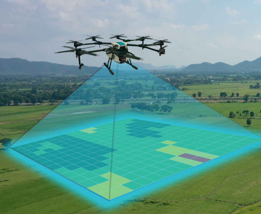
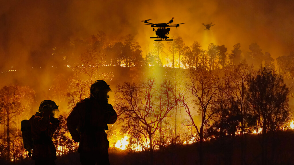
A hands-on drone mapping course within UVM’s GIS Certificate program — available as a standalone course.
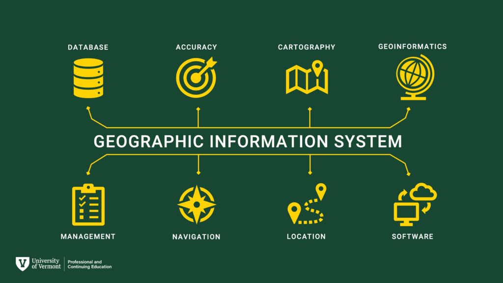
Geographic Information Systems (GIS) is the connective tissue of modern data analysis, seamlessly integrating economic, social, and environmental data information across spatial scales.
The Intro to UAS and Geospatial Applications course is perfect for professionals and students looking to build high-demand skills in drone mapping. Whether you are a GIS professional seeking to expand your toolkit, an environmental scientist wanting to improve monitoring techniques, a student in a related field, or a career-changer entering the geospatial industry, this course offers practical, real-world training to help you succeed. Its flexible online format is designed to fit your schedule while providing applied experience.

What You’ll Learn
By the end of this course, the student will be able to:
- Develop a comprehensive understanding of UAS technology, including flight safety, sensors, and regulations.
- Plan and execute simulated UAS missions for effective and efficient data collection.
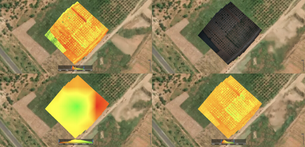
- Process raw aerial data using industry-standard software to create high-resolution orthomosaic maps and 3D models.
- Apply fundamental geospatial analysis tools to drone-captured imagery for real-world problem-solving.
- Communicate findings through professional-quality maps and data products suitable for environmental monitoring, land management, and more.

What You’ll Produce in This Course
Learn by doing and build tangible outcomes every step of the way.
By the end of the course, you’ll have created professional-quality maps, 3D models, and geospatial datasets. These outputs are designed to be portfolio-ready, giving you the confidence to showcase your skills to potential employers or clients. Whether it’s high-resolution aerial imagery, detailed terrain models, or comprehensive spatial data visualizations, you’ll leave with deliverables that demonstrate your expertise in geospatial technology.
- High-resolution aerial imagery for environmental monitoring or urban planning
- Detailed 3D terrain models for land development or geological analysis
- Comprehensive spatial data visualizations for decision-making in various industries
- Portfolio-ready maps that highlight advanced cartographic techniques
- Geospatial datasets tailored for solving real-world challenges
Gain New Skills or Grow a Hobby
Master the complete drone mapping workflow.
- Upskilling Professionals: Add drone data processing and analysis to your resume to stay ahead in your field.
- GIS Analysts: Learn how to integrate high-resolution drone imagery into your existing GIS projects.
- Researchers & Educators: Apply UAS technology to academic research and bring cutting-edge tools into the classroom.
- Hobbyist Pilots: Move beyond recreational flying and learn how to create professional-quality maps and models.
- Online Learners: Gain in-demand technical skills through a flexible, asynchronous program designed for working adults.
Apply to Your Current Role
Enhance your professional toolkit and bring new capabilities to your organization.
- Environmental Monitoring: Conduct detailed assessments of ecosystem health, track restoration progress, and map habitat changes.
- Land Management: Create up-to-date maps for site planning, infrastructure inspection, and resource management.
- Agriculture: Analyze crop health, monitor irrigation, and support precision farming techniques with aerial data.
- Urban Planning: Generate detailed 3D models of urban environments to support development and zoning decisions.
- Construction: Monitor site progress, calculate volumes, and create as-built surveys with speed and accuracy.
- Conservation: Map sensitive areas, monitor wildlife populations, and support conservation planning with high-resolution imagery.
Change Careers
Pursue various high-growth, technology-focused opportunities.
- Transition from Environmental Science to Geospatial Data Analyst
- Move from Construction to UAS Site Mapping Specialist
- Shift from a Corporate Job to Environmental Consulting
- Transition from Photography to Aerial Imaging and Photogrammetry
- Move from IT to Geospatial Technology
- Start a new path in Precision Agriculture, Forestry, or Resource Management.
Course Snapshot:
Intro to UAS and Geospatial Applications
Course Price
$1,600Upcoming Course Dates
Spring 2026 – February Start Fall 2026 – August StartAsynchronous Schedule
100% Online. On your own schedule!Weekly Commitment
10-16 HoursRegister Today and Get Started
Take the next step in your geospatial career. Whether you’re adding new skills, advancing in your current role, or changing careers, this course provides the tools and expertise to help you succeed. As part of UVM’s flexible GIS Certificate Program, it offers a direct path to mastering a leading-edge technology.
Seats are limited—don’t miss your chance to elevate your career!
Related Reading
We sit down with the course instructors —Dr. Paige Brochu, Adam Zylka, Lauren Cresanti, and Kelly Schulze from UVM’s Spatial Analysis Laboratory— to get an inside look at the curriculum, the learning experience, and the career outcomes for students:
Looking for More GIS Experience?
UVM’s Professional GIS & Data Communications Certificate Offers Comprehensive GIS Expertise
This 4-course, non-credit GIS & Data Communication Certificate is designed to help you succeed in the growing fields of GIS, geospatial analysis, remote sensing, geospatial computation, and data communication. Turn big data into useful information that helps solve real-world problems!
GIS Certificate Curriculum: Combine four courses together for a customized certificate!
- Introduction to GIS
- Advanced GIS
- Data Visualization and Communication
- Intro to UAS and Geospatial Applications
- Remote Sensing Foundations
- Environmental Modeling
- Geospatial Computation
- Independent Study
UVM’s GIS & Data Communication Certificate is designed to help you succeed in the growing field of GIS and geospatial analysis. No prior GIS experience or background in coding or computer programming is required.
Learn More about UVM’s GIS & Data Communication Certificate.
Ready to get started?
Request Information
Submit this form to receive additional program information.