
Launch into UVM’s GIS Certificate Program with the Intro to GIS Course
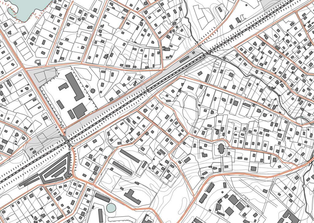
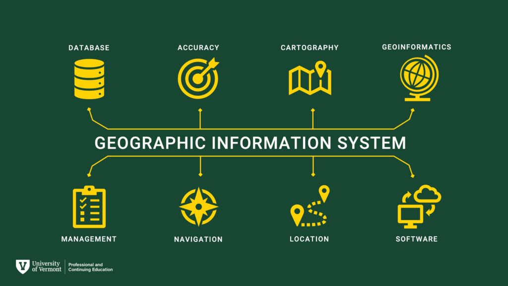
Geographic Information Systems (GIS) is the connective tissue of modern data analysis, seamlessly integrating economic, social, and environmental data information across spatial scales.
This Intro to GIS course will introduce the student to the basic principles and techniques of GIS through a mixture of readings, videos, slide-based presentations, and real-world examples. Participants will gain practical skills in the application of GIS to data analysis and problem-solving through the completion of lab assignments and participation in the course Discussion Forum.

What You’ll Learn
By the end of this course, the student will be able to:
- Develop a practical understanding of GPS and ArcGIS concepts and geoprocessing techniques. (e.g., data and file types, projections and coordinate systems, and spatial relationships)
- Perform spatial analysis using the most current version of ESRI’s ArcGIS Pro software.
- Practice effective communication using the technical language of ArcGIS, presentation-quality maps, and web applications.
- Use best practices for creating, storing, and managing data in a variety of geospatial and tabular formats.
- Gain experience identifying and accessing publicly available data.
All of this is delivered through a blend of readings, videos, presentations, lab assignments and active participation in our discussion forum for a comprehensive learning experience.
Who Should Enroll?
The Intro to GIS course at UVM is ideal for professionals and students who are eager to develop or enhance their GIS skills. Whether you’re a beginner wanting to learn the basics or someone in a field like conservation, urban planning, healthcare, or data analysis looking to integrate GIS into your work, this course is designed to meet your needs. It’s perfect for those seeking a flexible, online learning environment that fits into a busy schedule while providing practical, real-world applications to help advance careers across various industries.


Gain New Skills or Grow a Hobby
Establish new GIS knowledge and techniques.
- Teachers – Integrate GIS into K-12 classwork as a cutting-edge tool for future-focused data analysis.
- Upskilling Professionals – Refresh and advance your GIS knowledge to keep up with today’s evolving technology.
- Trainees – Elevate your GIS expertise beyond the basics to accelerate your career growth.
- Hobbyists – Explore your passion for geography by diving into innovative spatial technologies.
- Online Learners – Learn on your own schedule with a flexible, asynchronous program designed to fit your lifestyle.
Apply to Your Current Role
Enhance your professional toolkit and level up your GIS capabilities.
- Construction – Utilize GIS technology for efficient project planning, site analysis, and resource management to streamline construction processes and improve decision-making.
- Housing – Map resources for residents and analyze data to guide future investments.
- Environmental Restoration – Utilize mapping, research, and planning to drive restoration efforts.
- Data Journalist – Leverage mapping to visualize and communicate complex issues through compelling stories.
- Planning & Zoning – Apply systematic mapping for bus routes, charging stations, energy demands, and community infrastructure.
- Planning Consultant – Support municipalities with GIS mapping, including drone maps for utilities and infrastructure projects.
- Parks Department – Enhance compliance with the Wetland Protection Act while addressing broader GIS technology needs.
- Archaeology – Expand your toolkit with geoprocessing operations to uncover historical insights.
- Conservation – Capitalize on GIS-driven decision-making to support your team’s success.
- Physician Assistant – Analyze large health data sets on a national and global scale.
- Healthcare Research – Use ArcGIS to advance community and clinical health research initiatives.
- Students – Develop GIS skills to boost your career and contribute to academic projects like a master’s thesis.
Change Careers
Pivot into a GIS-focused career or explore new opportunities in conservation, geography, or urban planning.
- Transition from IT to GIS Specialist
- Move from Education to Urban Planning
- Shift from a Corporate Job to Field Work
- Transition from Software Engineer to Urban Mapping
- Move from Cybersecurity to Forestry Monitoring and Climate Data
- Depart from Seasonal Employment to Surveying and Resource Management
- Transition from the Telcom Industry to Geography and Conservation
- Move from Medical Research to an Environmental Field
- Start a new path in Conservation or Archaeology, or prepare for fieldwork opportunities.
Popular fields for Advanced GIS learners include Community Development, Planning and Zoning, Healthcare Research, Landscape Architecture, Forestry, Wildlife Management, Environmental Studies, and Geography.
Student Testimonials
“This course gave me the confidence to integrate GIS into my work as a community planner. The hands-on exercises were practical and directly applicable to my projects.”
– Sarah M., Urban Planner
“As a teacher, I loved learning how to bring GIS into my classroom. My students are now using mapping tools to analyze climate data, and it’s been a game-changer for their engagement!”
– David L., K-12 Educator
“I transitioned from a corporate IT role to a career in environmental conservation, thanks to the skills I gained in this GIS course. It opened the door to new opportunities I never thought possible.”
– Amanda R., Conservation Specialist
“The flexibility of the online program allowed me to learn at my own pace while working full-time. Now, I’m using GIS tools to advance healthcare research in my organization.”
– Michael T., Healthcare Data Analyst
“This course took my GIS skills from beginner to professional. I’m now applying what I learned to create detailed infrastructure maps for local municipalities.”
– Jennifer K., Planning Consultant
Course Specs:
Intro to GIS
Course Price
$1,600Upcoming Course Dates
Spring 2026 – February Start Fall 2026 – August StartAsynchronous Schedule
100% Online. On your own schedule!Weekly Commitment
10-12 HoursRegister Today and Get Started
Take the next step in your GIS journey with this Intro to GIS course. Whether you’re refining your current skills, applying them to a real-world job, or exploring a career change, this course provides the tools, support, and expertise to help you succeed.
Seats are limited—don’t miss your chance to elevate your career!
Looking for More GIS Experience?
UVM’s Professional GIS & Data Communications Certificate Offers Comprehensive GIS Expertise
This 4-course, non-credit GIS & Data Communication Certificate is designed to help you succeed in the growing fields of GIS, geospatial analysis, remote sensing, geospatial computation, and data communication. Turn big data into useful information that helps solve real-world problems!
GIS Certificate Curriculum: Combine four courses together for a customized certificate!
- Introduction to GIS
- Advanced GIS
- Data Visualization and Communication
- Intro to UAS and Geospatial Applications
- Remote Sensing Foundations
- Environmental Modeling
- Geospatial Computation
- Independent Study
UVM’s GIS & Data Communication Certificate is designed to help you succeed in the growing field of GIS and geospatial analysis. No prior GIS experience or background in coding or computer programming is required.
Learn More about UVM’s GIS & Data Communication Certificate.
Ready to get started?
Request Information
Submit this form to receive additional program information.