
Why Advanced GIS is Essential
GIS is the connective tissue of modern data analysis, seamlessly integrating economic, social, and environmental data information across spatial scales. This Advanced GIS course equips you with advanced techniques to expertly curate, analyze, and communicate technical spatial analyses to diverse audiences, preparing you to tackle real-world challenges with confidence.
What You’ll Learn
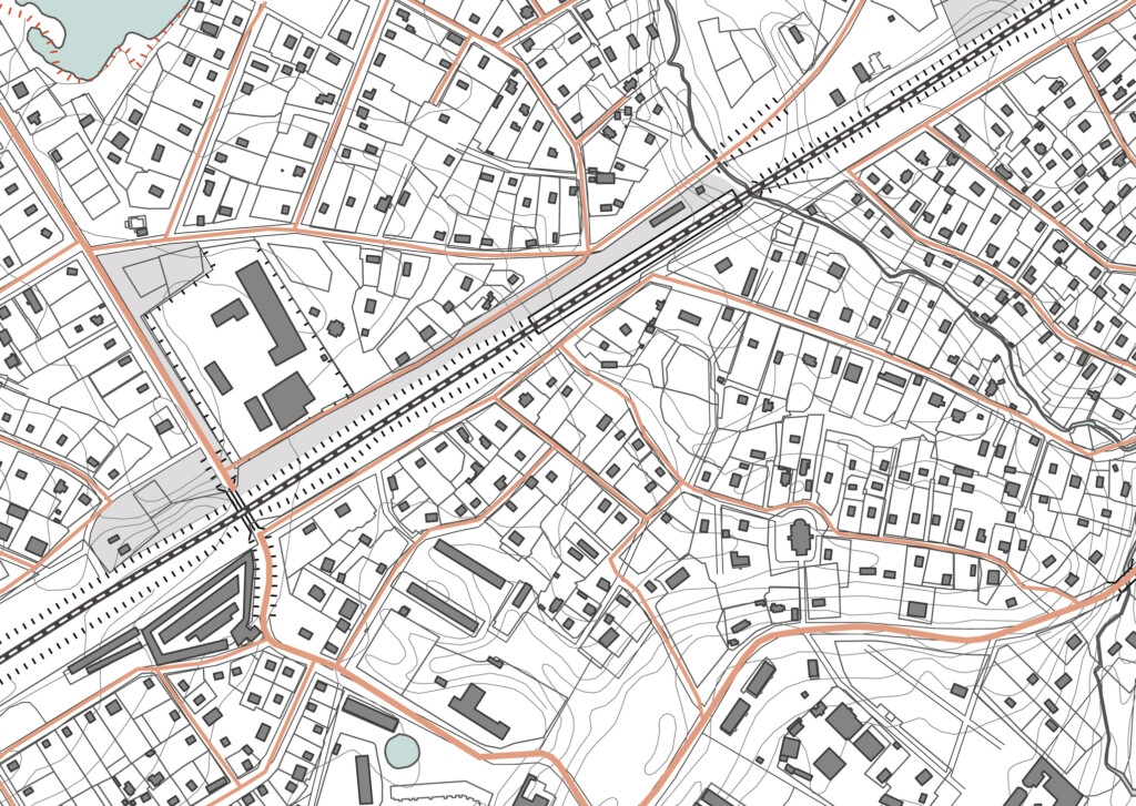
- Proficiency in ESRI’s ArcGIS Pro, the leading GIS software, to undertake hydrologic and network analyses, and create new raster datasets by interpolation.
- Gain experience with model builder and learn basic Python applications to help automate GIS analyses.
- Become more adept at analyzing GIS data and using the data to answer a specific research question.
- Build confidence in interpreting results and disseminating findings with more sophisticated maps and figures.
- Hands-on expertise through lab assignments and real-world examples.
All of this is delivered through a blend of readings, videos, presentations, lab assignments and active participation in our discussion forum for a comprehensive learning experience.
Who Should Enroll?
The tools, techniques, and insights you’ll gain in this Advanced GIS course will help you stand out in fields like environmental science, community development, urban planning, and conservation. Students interested in taking Advanced GIS at UVM should have a firm grasp on how data is managed and stored within ArcGIS programs as well as confidently navigate the interface of ArcGIS Pro.


Build Skills
Deepen your GIS knowledge and refine your ArcGIS expertise.
- Community Development – Build on your foundational GIS knowledge to create impactful projects.
- Landscape Design – Hone geospatial techniques for designing sustainable, innovative landscapes.
- Land Stewardship – Equip yourself with skills for assessing and managing natural resources.
- Graduate Students – Prepare effectively for spatial research in your field.
Apply to Your Current Role
Enhance your professional toolkit and level up your GIS capabilities.
- Urban Planning – Create insightful maps for public projects like the 2025 Town Plan.
- Conservation – Capitalize on GIS-driven decision-making to support your team’s success.
- Archaeology – Expand your toolkit with geoprocessing operations to uncover historical insights.
Change Careers
Pivot into a GIS-focused career or explore new opportunities in conservation, geography, or urban planning.
- Transition from IT to GIS Specialist.
- Move from Education to Urban Planning.
- Start a new path in Conservation, Archaeology, or prepare for fieldwork opportunities.
Popular fields for Advanced GIS learners include Community Development, Landscape Architecture, Forestry, Environmental Studies, and Geography.
Q&A with Instructor: J.Dennis Baldwin
Areas of interests: Archaeology, Remote Sensing, Lidar, Water Management, Subsistence and Settlement Patterns
How does the Advanced GIS course build off the Intro to GIS course?
“Advanced GIS builds on the skills developed during Intro GIS. Students will continue to work with vector and raster based data, and will learn to integrate analyses of both datatypes and manipulate them in new and more complex ways.”
Can you outline examples of specific ARCPro Tools? (beyond what’s covered in Intro to GIS)
“Students will use new toolsets from ArcGIS to undertake hydrologic and network analyses and create new raster datasets by interpolation. Additionally, students will gain experience with modelbuilder and learn basic python applications to help automate GIS analyses.”
What disciplinary techniques covered are in the Advanced GIS course? (beyond what’s covered in Intro)
“By taking Advanced GIS, Students will become more adept at analyzing many types of GIS data and learn how to use them to answer a specific research question. Moreover, students will gain confidence in interpreting their results and disseminating their findings with more sophisticated maps and figures.”
What skills are Advanced GIS students expected to already have, if wish to bypass Intro to GIS?
“In order to bypass the Intro to GIS course and start with Advanced GIS, the student must have a firm grasp on how data is managed and stored within ArcGIS programs and the difference between different file types. They must be able to confidently navigate the interface of ArcGIS Pro, and must know the basics of creating simple map layouts.”
Course Snapshot:
Advanced GIS
Course Price
$1,600Upcoming Course Dates
Spring 2026 – April Start Fall 2026 – October StartAsynchronous Schedule
100% Online. On your own schedule!Weekly Commitment
10-12 HoursLooking for More GIS Experience?
UVM’s Professional GIS & Data Communications Certificate Offers Comprehensive GIS Expertise
This 4-course, non-credit GIS & Data Communication Certificate is designed to help you succeed in the growing fields of GIS, geospatial analysis, remote sensing, geospatial computation, and data communication. Turn big data into useful information that helps solve real-world problems!
GIS Certificate Curriculum: Combine four courses together for a customized certificate!
- Introduction to GIS
- Advanced GIS
- Data Visualization and Communication
- Intro to UAS and Geospatial Applications
- Remote Sensing Foundations
- Environmental Modeling
- Geospatial Computation
- Independent Study
UVM’s GIS & Data Communication Certificate is designed to help you succeed in the growing field of GIS and geospatial analysis. No prior GIS experience or background in coding or computer programming is required.
Learn More about UVM’s GIS & Data Communication Certificate.

Ready to get started?
Request Information
Submit this form to receive additional program information.